
Scope of Project
In the fall of 2011 the Corps of Engineers, through the Indefinite Term Contract, requested Hughes & Associates to perform multibeam bathymetric survey of the harbor, topographic survey of the surrounding basin, and verification of the survey control of the Small Boat Harbor in Akutan, Alaska. At the time of the survey the harbor was still under construction and was not completed until 2013. Akutan Harbor is unique in its location as there are no overland roads, trails, or paths connecting the harbor to the City of Akutan. All access between the harbor and the city requires either a two mile boat ride or a challenging scramble along the beach and hillside. Due to multiple storms, severe weather, and the freezing of the boat harbor, data collection was delayed until the spring of 2012. The required bathymetry and topographic survey was performed between May 14 and May 18 of 2012. The survey crew traveled to Akutan through the use of Pen Air between Anchorage and Unalaska and a private vessel charter from Unalaska and Akutan. Daily travel to the project site from the City of Akutan was through a local landing craft. All hydrographic data collection was conducted on a vessel of opportunity supplied by the Corps of Engineers' COR utilizing Hughes & Associates custom mobile sonar mount.
About the Harbor
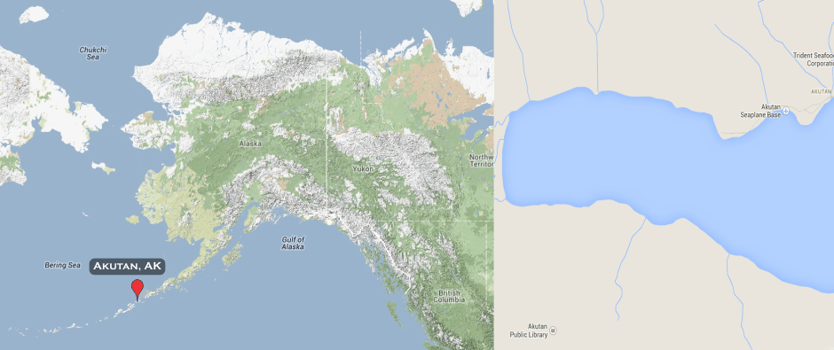
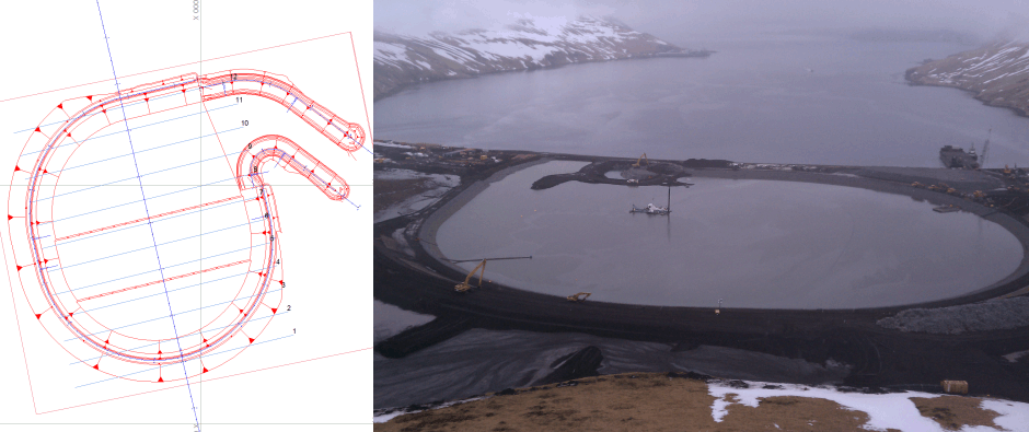
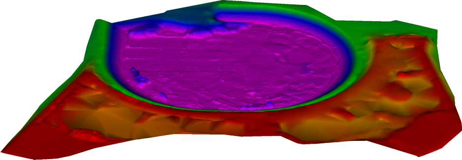
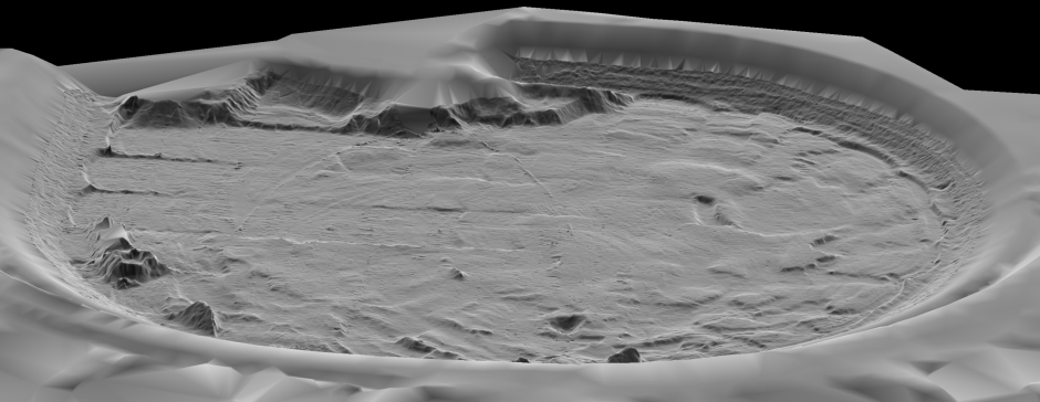
Akutan Small Boat Harbor is located on Akutan Island approximately two miles west of the city of Akutan at the head of Akutan Harbor. The city of Akutan on Akutan Island is part of the Aluetian Islands in western Alaska approximately 766 miles southwest of Anchorage and 35 miles east of Unalaska. The small boat harbor is a circular shape approximately 1000 feet north-south by 900 feet east-west with the entrance channel at the northeast corner of the harbor. The harbor is designed with three different project depths of -14.5', -16.5', and -18.5' mean lower low water (MLLW). The -18.5 MLLW project area includes the entrance channel and the north one-third of the harbor, the -16.5 MLLW project area includes the middle one-third of the harbor, and the -14.5 MLLW project area includes the remaining southern one-third of the harbor. The harbor provides shelter and moorage to the local residents’ vessels and to the year-round commercial Bearing Sea fishing fleet that provides its catch to the Trident fish processing plant in Akutan.